香港車禍傷亡資料庫 | Hong Kong Traffic Injury Collision Database
By Kenneth Wong in Web Application
November 1, 2022
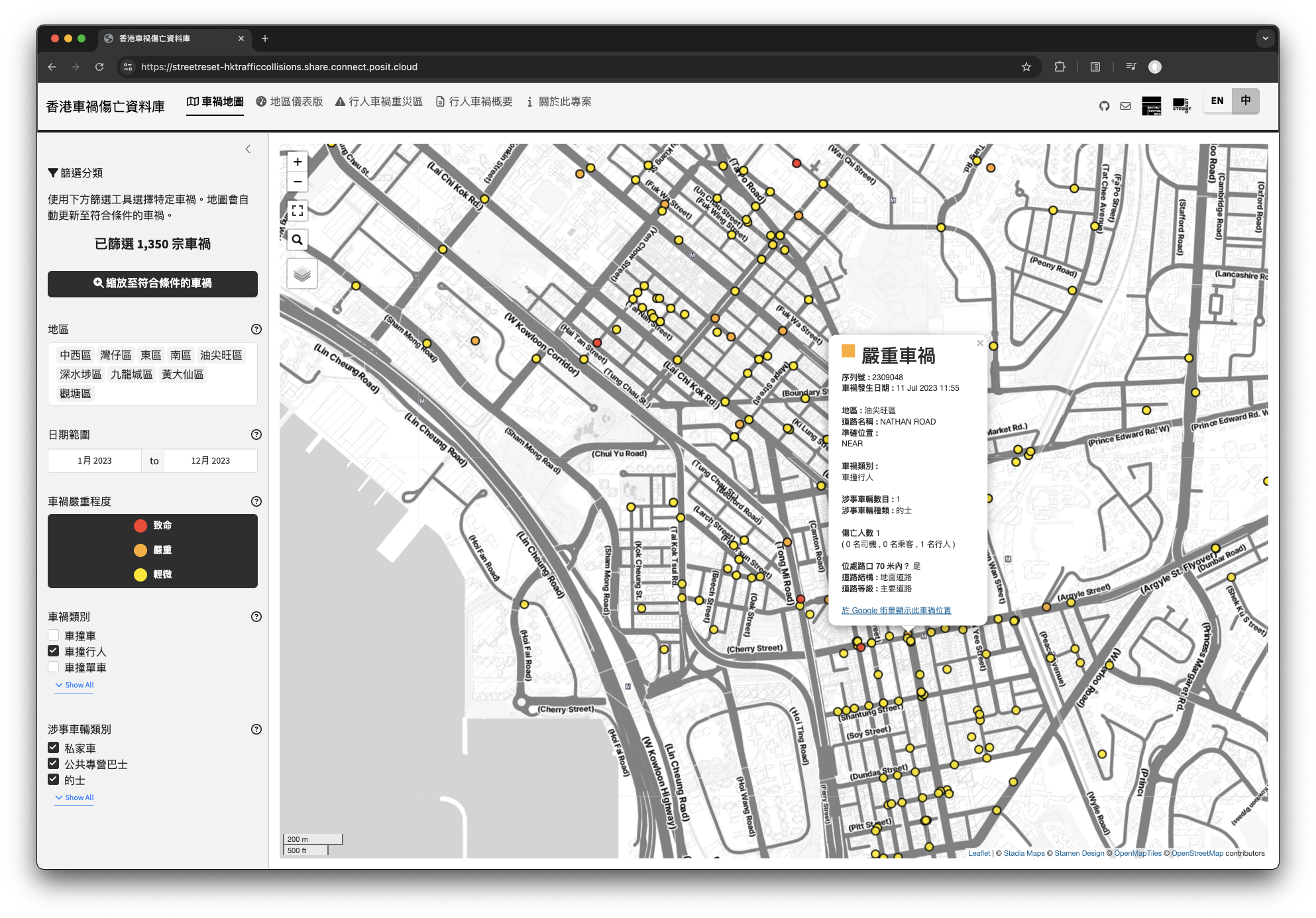
Collision Map
Hong Kong Traffic Injury Collision Database is a project co-developed by Street Reset and Hong Kong District Info, which aims to visualise Hong Kong traffic collision data with interactive mapping. The objective is three-fold:
- To alert the public on the current severity of traffic collisions in Hong Kong, with particular dire implications for pedestrians and cyclists,
- To draw attention to how street design has contributed to the current situation, and what systemic remedies should be made to enhance the safety of vulnerable road users, and
- To provide journalists, district councillors, and government departments with insights and map-based data evidence to understand this issue.
Major features of the website includes:
- Collision Location Map: An interactive map for users to explore the locations of traffic collisions, with custom filter (collision severity, date, vehicle type involved, etc.) to subset the database according to users’ specific needs
- District Dashboard: A dashboard to summarise the number of collisions and characteristics of collisions by 18 districts in Hong Kong
- Pedestrian Collision Hotzones: An interactive map showing location and information of the “pedestrian-related traffic collisions disaster area” identified using the Hotzone analysis method.
香港車禍傷亡資料庫是街道變革和 Hong Kong District Info 共同開發的項目,旨在利用互動地圖和儀表版,將香港車禍位置和相關數據可視化。這個項目有三個目標:
- 提醒公眾注意目前香港車禍的嚴重性,尤其是對行人和單車使用者的嚴重影響
- 讓各方注意到街道設計如何導致目前的情況,以及應採取哪些系統性的補救措施,以提高弱勢道路使用者的安全
- 為記者、區議員和政府部門提供簡易數據和見解,有助深入探討及改善車禍問題
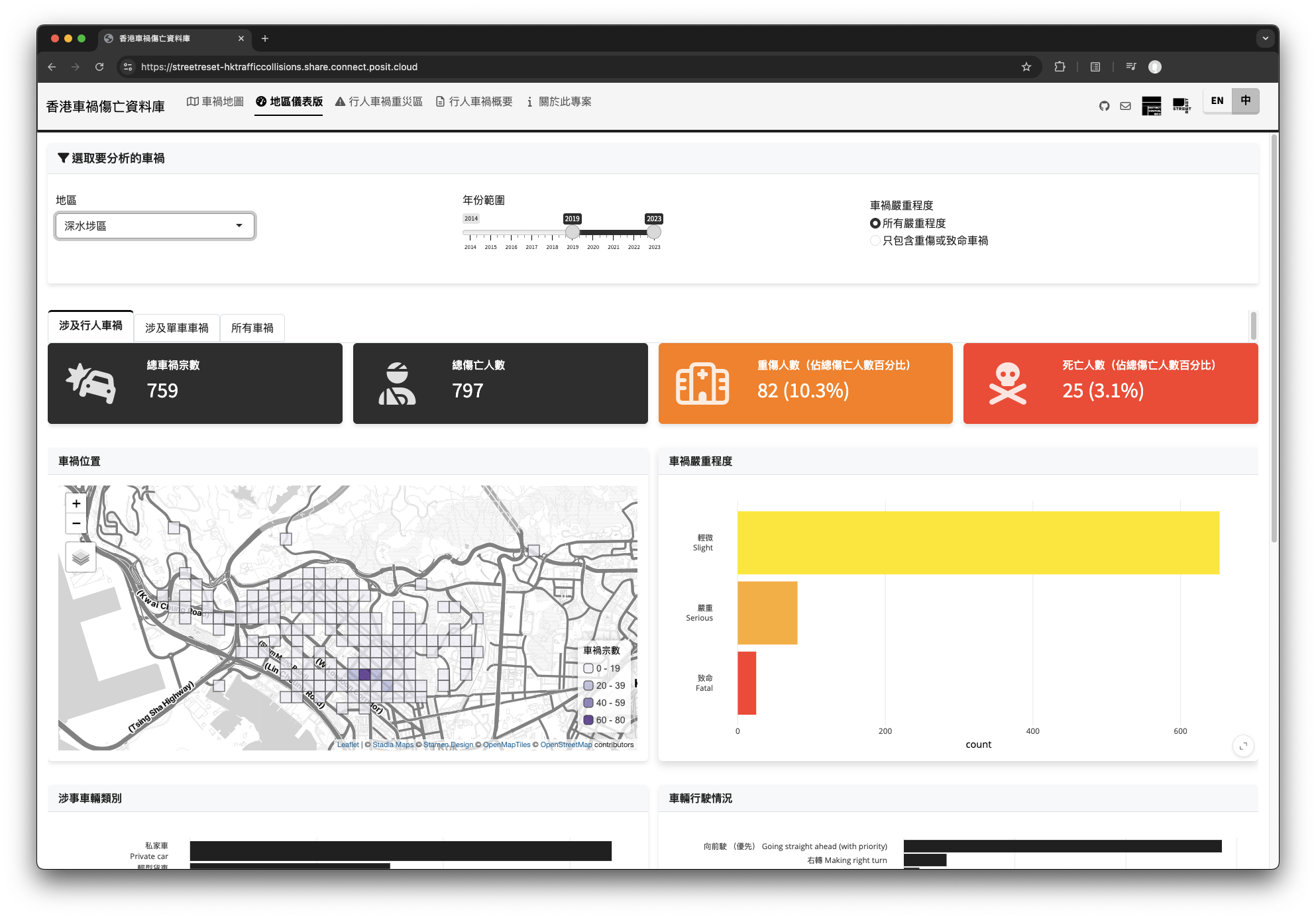
District Dashboard